|
|
Application
- Remote Sensing
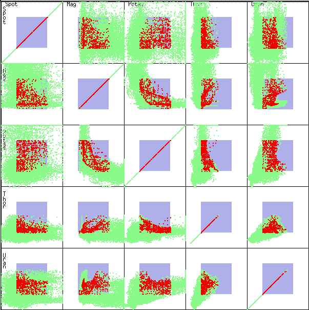
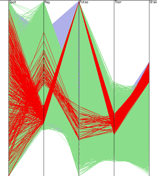
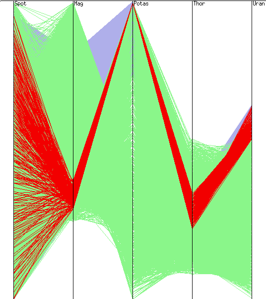
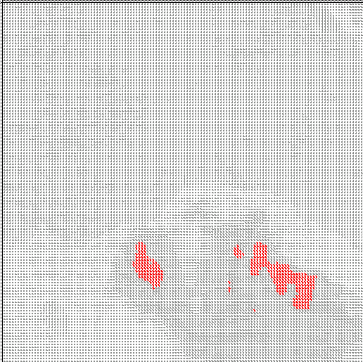
This case
study shows the application of XmdvTool to remotely sensed data.
5 distinct channels (Spot, magnetics, 3 bands of radiometrics)
are combined for a particular region in Western Australia. The
third radiometrics band, which highlights Uranium, is the focus
of exploration. The user brushes over the parallel coordinates
display on the high Uranium region to identify 2 distinct "signatures",
one with high potassium and low magnetics, and the other with
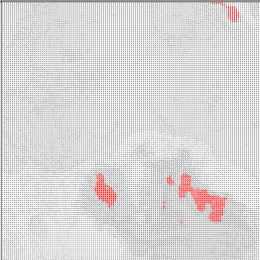
moderate levels of each. The glyph display, because we are dealing
with a square geographic region, places glyphs based on spatial
positions. Thus we can see the geographic regions (in red) which
correspond to high uranium. Note the shading which manifests itself
with small glyphs - changes in shading correspond to changes in
one or more of the dimensions. By focusing the brush on high potassium
and returning to the glyph display, we localize the regions with
this characteristic signature.
|